Old Warehouse, Glasnevin, Dublin


PROJECT OVERVIEW
AltiGeo was appointed to carry out a measured building survey of an old warehouse in Glasnevin, Dublin 9, along with an external topographical survey extending to the entrance of the site.
The client required accurate existing information for the warehouse structure, internal layout, surrounding levels and site access. The survey data was intended to support the design team with reliable information for future planning, coordination and development of the site.
Scope of Services
The survey included both internal and external data capture, combining laser scanning with traditional topographical survey methods.
Internally, the focus was on capturing the warehouse structure in detail, including walls, columns, beams, roof structure, openings and changes in levels. Externally, the topographical survey recorded the site entrance, surrounding hardstanding areas, boundaries, levels and key site features.
Survey Methodology
The external topographical survey was carried out using a Leica total station, allowing the team to accurately record site levels, kerbs, thresholds, boundaries, entrance points and surrounding features.
Survey nails were installed where necessary to create fixed control points across the site. Black and white scan targets were also positioned strategically and observed as part of the survey control network. This allowed the pointcloud, measured building survey and topographical survey information to be accurately coordinated within the same dataset.
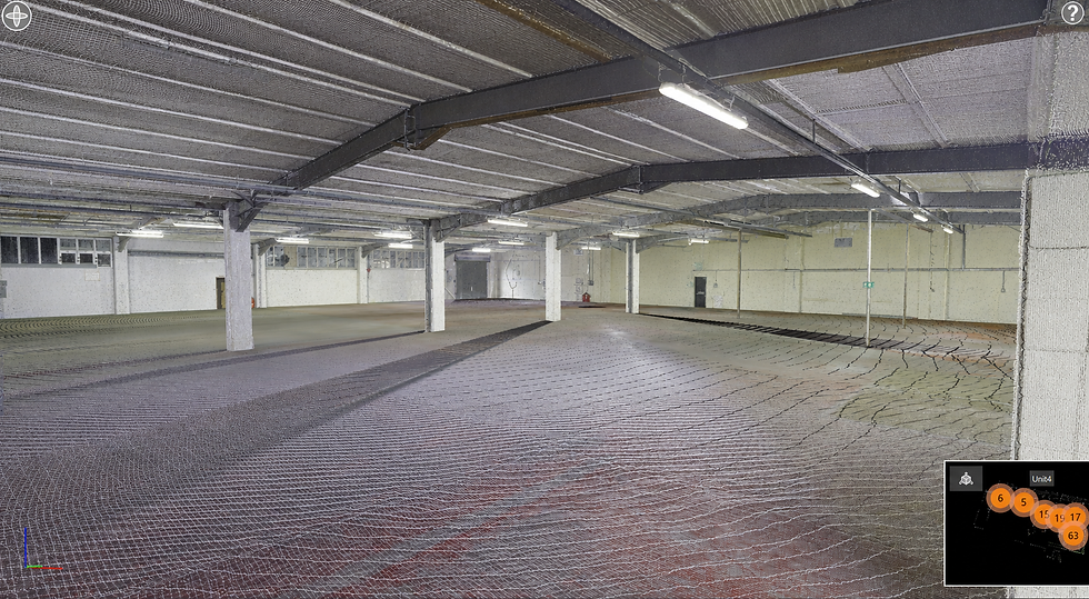
Internal Laser Scanning
High-density internal scans were carried out within the warehouse to ensure the main structural elements were captured clearly and accurately.
This was particularly important due to the industrial nature of the building, where exposed structure, large-span spaces and changes in building fabric needed to be recorded in detail.
High-density internal scanning was undertaken to accurately record the key structural components of the warehouse, including:
-
Primary steel frame
-
Roof trusses and purlins
-
Structural columns
-
Beams and bracing members
-
Load-bearing walls
-
Internal masonry walls
-
Floor slab levels and changes in level
-
Door and window openings
-
Thresholds and structural openings
-
Roof profile and eaves levels
-
Existing mezzanine or raised platform areas
The scan data provided a reliable digital record from which accurate CAD drawings and a BIM model could be produced.
High-density internal scanning was undertaken to accurately record the key structural components of the warehouse, including:
-
Primary steel frame
-
Roof trusses and purlins
-
Structural columns
-
Beams and bracing members
-
Load-bearing walls
-
Internal masonry walls
-
Floor slab levels and changes in level
-
Door and window openings
-
Thresholds and structural openings
-
Roof profile and eaves levels
-
Existing mezzanine
Deliverables
-
Topographical survey CAD
-
Measured building survey CAD
-
BIM model of the warehouse
-
Revit topography
-
Internal and external walkthrough
Project Outcome
The completed survey provided the client and design team with a coordinated record of the existing warehouse and surrounding site conditions.
By combining total station survey control, topographical data and high-density laser scanning, AltiGeo delivered a detailed survey package suitable for design coordination, refurbishment planning and future development of the industrial site.